Sunday, October 8, 2017

Claiming Plainfield, N.H. (#146) and running amid the pumpkin people

Where I started, and also where I finished.

Pretty nice fall day for a run: a bit warm but overcast, with a light rain falling.

But whatever the weather, I sure picked the right time of year to pick off Plainfield, N.H., making it Town #146 in my quest to run a minimum of 10K in every town, city, or unincorporated place in New Hampshire.

I didn't know this, but turns out October is when the Pumpkin People emerge in Plainfield. Not content with mere Jack-O-Lanterns, it's an annual tradition for town residents to create elaborate roadside tableaux featuring everyone's favorite seasonal gourd.

How elaborate? How about this re-enactment a scene from the movie 'Titanic' (1997), which I passed on Stage Road?


How about something more topical, such as this eclipse-watching pumpkin astronomer?


Driving too fast? Meet the Pumpkin-As-Officer-Running-Radar, posted on a fast stretch of Route 12A north of town?


Officer, why are you smiling at me like that?


And how about this whole pumpkin family, stepping out?


So altogether, this made for a pretty entertaining run. And when there weren't pumpkin people, other objects of interest filled the gaps:


Want something more Halloween-like. How about the town's picturesque village cemetery, which seems to have plenty of open space...


And yes, before I forget: I did go for a run: a nice out-and-back on Route 12A, which for much of its journey through Plainfield is a narrow winding highway with no shoulder to speak of.

But about a mile-and-a-half before Plainfield Village, the road suddenly broadens to a whole new and more generous set of specs, with great visibility and a wide breakdown lane.

The post office in town was exactly 1.6 miles (by my odometer) from this point, so that was my route: out and back, a total of 3.2 miles.

As a bonus, the widened highway started at a crest in the road, just before a long series of smooth and gentle downgrades into the town.

Where Route 12A widens, facing south towards Plainfield Village.

So it was mostly gentle uphill to the turn-around point, then a nice forgiving downhill all the way back.

If any of the landscapes seem familiar, it's because Plainfield was for many years home to renowned American artist and illustrator Maxfield Parrish.

Although Parrish passed on in 1966, he's still a big man around town. In the Village, I ran past the old town hall, which boasts a set of scenery designed and painted by Parrish back in 1916, and it was open for weekend visitor scrutiny. (I demurred, not wanting to drip on the historic Parrish set pieces.)

Back at the post office, a bulletin board of real estate notices included what seemed to be a major one: for the first time in decades, the actual 45-acre Maxfield Parrish estate, known as "The Oaks," was up for sale!


Wow! If you've got a spare $1.3 million, it could be yours. It all sounds pretty nice, although you might end up being asked to paint some new scenery for the Town Hall.

And what about my time? I'll call it 37 minutes even to run 3.2 miles, good enough for claiming the Connecticut River Valley town of Plainfield and filling in a gaping hole in my office map, which I did this morning.


What's next? Now that I'm back in the local running groove, I'd like to pick up a few more towns before the weather turns. Maybe get to #150—we'll see.

Stay tuned!

Thursday, May 25, 2017

Bike routes, plus some notes about Summer 2017

This season I've had it in my mind to do what I call the "New Boston loop" before Memorial Day weekend.

Well, I'll be on the road for Memorial Day weekend, so I took advantage of a warm late afternoon yesterday and did it.

The apex of the loop is "downtown" New Boston, a small crossroads with Dodge's Store as a landmark:

Click to enlarge.

The route out is rolling countryside with many ups and downs, but none really epic.

Going back, it's a different story. Check out the hill, circled in the grade profile at left:


That's the big climb up one side of the Uncanoonuc Mountains in Goffstown, of which Wallace Road skirts the eastern slopes.

It's not bad, but loooong, and climaxed by a couple short but very steep pitches before cresting the high point at Shirley Hill Road.

Then it's a long glide back to home base. Total distance: 28.3 miles. Time: about 2.5 hours, but I didn't really time it closely.

The other looping bike route I've been doing since the weather changed is a much more level loop that takes me south along one side of the Merrimack River to my hometown of Nashua, then back up on the other side.

Here's the route down, which runs through countryside that's still quite rural, with a lot of land in active farming:


And here's the route back, which is mostly through suburbia:


Total distance on this loop is 31.5 miles: longer than the New Boston circuit, but because it's more level it usually takes no more than 2:15 to complete.

One thing I like about this route: both directions take you near the enormous Anheuser Busch brewery in Merrimack, N.H. You can tell which direction the wind is blowing when you encounter the aromatic cooked malt fragrance that comes from the place.

What's next? Before I start longer rides out to the hilly west, or east to the coast, I need more time closer to home.

So one loop I will try is to go counter-clockwise completely around the city of Manchester.

Using the Auburn Village School as the apex, the first part of the route would look like this:


Then back, the lack of bridges over the Merrimack to the north means I'd have to come through Manchester's North End to get home:


So the total mileage is 33.3, a slight increase and a new route besides. I'll try that one when I'm back in town after Memorial Day weekend.

Longer term, I'd like to bike at least once to the coast (for fried clams at Ceal's Clam Stand in Seabrook, N.H.)and then all the way back. Long ride of about 95 miles.

Here's my preferred route out:


Coming back is a challenge, with a steep climb from Candia into Hooksett on Route 27, then a descent into the Merrimack Valley:

This route map has me heading in the wrong direction. :)

And two routes to the west: one a loop out to Harrisville Pond (for a mid-day) swim and then back, about 90 miles through some very hilly terrain; the other a long one-way to Bellows Falls, Vt.

Injury-free right now but just overworked with not enough time to push myself. Not running too much but will try capturing a few towns this season.

Updates as they happen.

Monday, February 13, 2017

Getting my chest shaved in London,
and other adventures in the ER

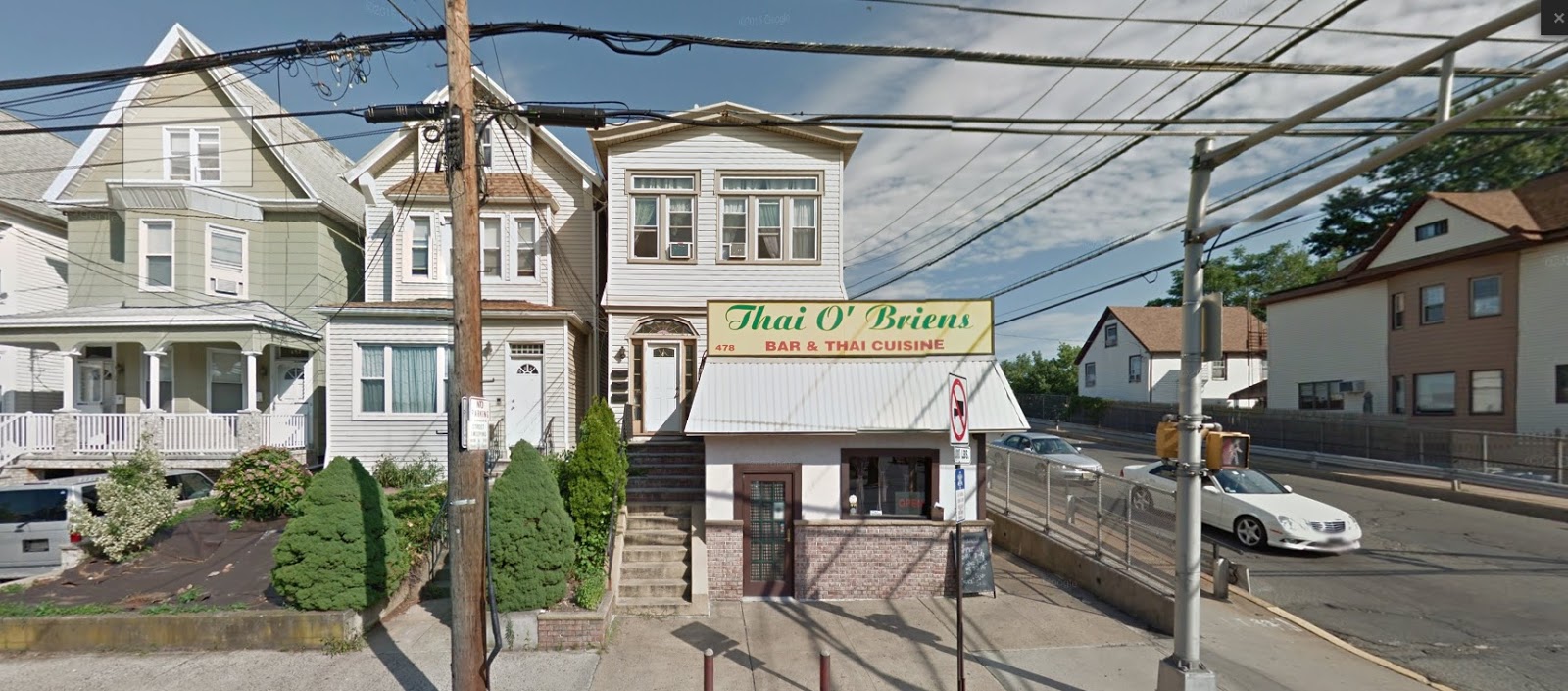
Souvenir from St. Mary's Hospital in London: the readout showing where my rapid heart beat was halted, then restarted at a slower pace. Click to see detail.

We travel to London for the theater. But a brief visit last week brought some unexpected drama in which I played a leading role.

The story: in the wee hours of Saturday morning, I awoke to find my heart beating much faster than normal.

Also stronger than normal: BAM! BAM! BAM!

I couldn't imagine why this was happening at 2 a.m. I hoped it would just go away, but I couldn't get back to sleep.

So after an hour, I woke up my wife. She measured the pulse as 140, and it showed no signs of abating.

What was up? Was it finally time for my big life-changing health collapse?

Time crawled by. Earlier that evening, we had seen 'Fawlty Towers: The Dining Experience,' a dinner-theater recreation of the iconic British TV sitcom.

Now, lying there, I found myself thinking of several 'Fawlty Towers' scenes set in British hospitals, and also of the episode where a hotel guest dies overnight.

That led me to think of a good option for an epitaph, should one be needed. It's what John Cleese says to three hotel guests whom he mistakes for undertakers.

"Your dress is very modern," he tells the bewildered trio. That would work well on a gravestone, I thought.

I know this sounds ludicrous. But what else would you think about in a hotel at 4 a.m. with your heart racing like you're running a marathon?

Daylight came at about 6:30 a.m. By then I was seriously short of breath and feeling light-headed, so we knew I'd have to get checked out.

One issue: my wife's relatives were scheduled to arrive in London by train at 8:50 a.m. for an action-packed day.

Well, it was clear I wasn't up for that. Just climbing the stairs to the lobby (we were in a lower level) made me feel like taking a siesta.

Fortunately, St. Mary's Hospital was two blocks from the hotel. I felt well enough to walk to the ER. So that's what I did.

My wife would meet the relatives at the train and wait to hear from me.

The main gate at St. Mary's Hospital in London.

So I trudged across Praed Street and entered the St. Mary's campus. A map directed me to the emergency department, and a woman at a desk sent me upstairs. (Yes, I took the elevator.)

The hotel desk clerk had advised I might want to wait for an urgent care clinic to open because St. Mary's, as a large inner-city hospital, could be kind of a madhouse.

But early on a Saturday morning, I was the only customer. No waiting! Thus was my introduction to Britain's National Health Service.

And get this: besides my symptoms, all they needed from me was my name, address, and (because I was a foreigner) my passport info.

I was then put in a wheelchair and rolled down a corridor to the ER, where I was evaluated by several nurses working as a team. Everyone wore the same blue hospital clothes.

Before long, my chest was partially shaved so they could attach sensor contacts to me. I was placed in a gurney and wheeled into a medical room, with my heart racing as fast as ever.

All this before 8:30 a.m.!

Two doctors, Danny and Helen, tried non-invasive methods to corral my pulse: having me blow into a syringe, and then giving me a neck massage. (Thanks, Helen! I mean, Dr. MacKay.)

These had no effect, so the decision was made to use a drug that Dr. Danny warned me had an unusual effect: people who take it, he said, "feel like they're doing to die."

What? They feel like they're dying? What does death feel like, exactly?

What he meant was that the drug, Adenosine, would temporarily stop my heart from beating (for the first time since 1964!), and then very soon after it would start again, ideally at a normal rate.

But that time in-between was what people described as death: with the heart shut down, the body instinctively begins going into shock. The heart restarts before this gets too far, but it can be very scary if you're not prepared.

"Can I have a lollipop?" I asked, laying there, still wondering if this was what Redd Foxx used to call 'The Big One' on the old Sanford & Son TV series. (Wow, everything in life is related to TV!)

Before I got an answer, 6 milligrams of Adenosine were released into me through an IV.

I waited for death...but death did not come.

The verdict: I was a bigger moose than they'd figured. Hence the next step: double the dose!

In went 12 milligrams of Adenosine, and then I felt it.

For me, death felt like a huge weight pressing on my chest, and then quickly morphed into the sensation that there was some kind of strong vacuum pulling at my chest from the inside, trying to collapse it.

I tried inhaling but couldn't. I closed my eyes in response to this, and found I couldn't open them!

But before anything else happened, my heart resumed beating, and at a much lower pulse rate of 90. It would drop further as I returned to normal.

Laying there, I was overcome with a huge sense of relief that was physical and mental. The moment my heart resumed at a normal rate, everything felt right again, finally.

Also I was relieved that I'd have time to think of a better epitaph than "Your Dress Is Very Modern."

After making sure I was stable, the doctors wheeled me into a holding area, where I needed to wait until they got blood test results back from the lab.

The hospital had great wifi, so I updated the wife and wished them all a good time! I would try to catch up later if I could.

The actual Emergency Department within the hospital, which is named after the Queen Mother, a long-time patron.

So for the next six hours, I got to watch the ER of a busy London hospital in action. It wasn't that busy, actually, but still a lot was going on—a broken femur here, a fall with head injury there.

More than once I heard people being asked "Who is the Prime Minister?" or "Who is on the throne?"

At about noon, Dr. Danny and Dr. Helen came by with an update. My results were fine. But because I was going to be on a long flight the next day, they wanted to keep me for one more round of blood tests as a precaution.

Specifically, they wanted to see if levels of a certain type of enzyme were increasing, which would indicate damage to the heart muscle or possibly another cardiac malfunction in the making.

By 3 p.m., the second results were in: I was free to go. And that's when I got my biggest surprise.

After putting myself back together, I asked Dr. Helen what I needed to do next.

"You're discharged," she said. "You just go."

"Go where?"

"Out of the hospital," she said, realizing that I was one of those foreigners who may not understand how National Health works.

"Isn't there some kind of paperwork I have to fill out—disclosure forms or insurance info?"

"You have a discharge paper, which you should bring to your G.P. back home," she said. "Emergency care is provided free to everyone."

There's a phrase you don't hear in U.S healthcare. Free to everyone!

You mean, I just took up eight hours of time in the ER of a major London hospital, and the cost is...nothing?!

Even better—I found out later that if I had travel expenses, I could take receipts to the bursar's office for possible reimbursement. Wow. In Britain, they pay you to go to the hospital!

But what impressed me most was the sheer simplicity of the transaction. No paperwork. No forms. No codes or waivers or disclaimers or disclosures.

And no gigantic billing infrastructure that adds to costs without medically helping anyone.

Of course there are costs. Someone had to pay for the services I received. In this case, it was the British taxpayer.

It didn't seem proper to take photos inside the ER, but I did furtively snap this one shot of my "holding cell," which had a nice view of a canal filled with houseboats.

But that same taxpayer does not have to pay always-rising insurance premiums or cope with massive deductibles like we do.

Example: Last month I had an MRI done as a precaution. The total cost for this two-hour procedure was just under $10,000, of which I had to pay 20 percent.

Thinking about that bill would be enough to prompt a cardiac incident.

But in my case, what seems to have been the culprit in London was me unthinkingly downing five or six cups of coffee during the previous day, and then drinking beer and wine in the evening, topped off by more coffee.

By the time we got back to the hotel, it's no wonder my heart went into overdrive.

But I'm fine now. It's been three days and no sign of any relapse. I even had a cup of coffee today!

So all's well that ends well. Speaking of which, I do need to work on finding a better epitaph...

Tuesday, October 18, 2016

Bagging Croydon (#144) and Granthan (#145)
in the quest to run 5K in all N.H. locations

Where I didn't want to leave my car.

If we ever have to do without cars, I know how long it would take to get from Croydon to Grantham, N.H.

I ran a "back-to-back" in those two towns this past Saturday, making them #144 and #145 in my quest to run a minimum of 5K in every city, town, and unincorporated place in New Hampshire.

And unlike a lot of these runs, this one worked out to be between the two actual villages rather than just out in the middle of nowhere, although there was certainly enough of that. Read on!

The date: Saturday, Oct. 15. Due in Brandon, Vt. that evening for a performance, my original plan was to veer further north and knock off two more-distance communities: Wentworth and Warren.

But a late start and then heavy traffic on Interstate 93 heading north prompted me to change plans before the I-93/I-89 split.

I didn't really have a Plan B, but realized en route that Croydon and Grantham were two towns I needed, and were just off I-89 on the way to Vermont.

So up I went, taking Exit 13 in Grantham and following Route 10 south towards Croydon.

Good old Route 10, which wanders through the western part of the Granite State from the Mass. line all the way up to Hanover and Dartmouth College.

I actually once wrote a travelogue about Route 10 for New Hampshire Magazine some time ago. It doesn't seem to be online anywhere—perhaps I'll fish it out of the archives and post it later.

Travelogue or not, here I was again on Route 10 as it wound its way along the shallow valley of the North Branch of the Sugar River, which was just beginning its long journey to the Connecticut River.

My usual method of a "back-to-back" is to find the boundary between two towns, then pace off 1.6 miles in each direction, noting the turn-around point at each end.

I then return to the border and head out in one direction as far as the turn-around point, then head back and cross the border in the other direction.

At the second turn-around point, I then head back the start, which is now the finish line.

As long as I've done the math right, that's a minimum of 3.2 miles in each community. And that exceeds my minimum distance of 5K, which is 3.1 miles.

One reason this works so well is that for some reason, New Hampshire communities are very good about marking the town lines.

Maybe it's due to road maintenance obligations. Maybe just a turf thing. But in New Hampshire, roads in and out of even the smallest, most remote towns invariably sport flashy green border markers.

The roads themselves may be crumbling to pieces, but the signs always seem look brand new.

Look at the size of that breakdown lane!

In this case, Route 10 wasn't falling to pieces. On the contrary: it was clean and dark and newly paved with a smooth surface and a gentle crown.

The speed limit was as high as 55 m.p.h. on long "straightaways" (as we call them), but a generous breakdown lane would keep a runner from feeling any danger.

The Grantham/Croydon line happened to be right in the middle of one of these straightaways, out in the open for all to see.

One disadvantage to this to this: there was no convenient place to stow my car. Not that anything would happen here, other than a bear coming by to ransack the vehicle.

I just don't like leaving it out in the open while I'm off jogging around.

I then hopped back in to measure off 1.6 miles into Croydon to find my turn-around point. To my surprise, the village of Croydon came up quite quickly: the historical society, the church, the school, the Coniston General Store.

That last one is a nod to the 1906 novel "Coniston" by New Hampshire author Winston Churchill, not be confused with the British politician of the same name.

"Coniston," a best-seller, was an historical tale set in the world of 19th century New Hampshire politics. Locations included the fictional town of Coniston, which was a stand-in for Croydon.

And the turnaround coincided exactly with Pat Sawyer Memorial Park, completely deserted but with a nice parking area.

And right across the highway: Milepost 60.0. So I immediately decided to base myself here: 1.6 miles from the town line. I would run back up the highway, over the town line into Grantham, and then as far as Milepost 63.2.

I'd then turn around and retrace my steps. Presto! Two towns, and a little more than 5K in each.

And so it came to pass. The afternoon was warm for October: temps in the high 50s, but with almost no wind.

High clouds were moving in from the south, filtering out the sun and muting the fall colors all around me. A pretty good day to be out for a run.

I'll meet you at the old barn. You know—the old barn!

I started at 1:32 p.m., heading north, accompanied mostly by the sound of my own feet on the pavement, the occasional passing vehicle, and occasional bursts of rifle fire from the woods.

One virtue of Route 10 following the valley of the North Branch of the Sugar River is that even though we were high in the hills, the course was almost completely flat!

The only grade at all was a short bump up into the town of Grantham proper, at the far end of my route.

The exact turn-around spot of Milepost 63.2 was at Grantham's Dunbar Library, across from the United Methodist Church. Village to village!

And I couldn't help but think I had covered the distance between both towns on foot in a way that must have been much more common say, a hundred years ago.

In case anyone wants to know: people can still do it, if they have to. I did, anyway.

I felt strong pretty much the whole way. No foot pains, no issues at all.

As I strode through Croydon on final approach, I was surprised to find Pat Sawyer Memorial Park now being used by three men at the lone basketball net, shooting hoop.

They left me alone, and I left them alone. But if they were curious about the guy in the orange shirt and black shorts running through their town last Saturday—well, he made it to Grantham and back in exactly 1 hour and 20 minutes.

The distance was 6.4 miles, meaning a pace of 12:30. That's somewhat better than what I've logged lately, probably because of the flatness of the course and the pleasantness of the weather.

Next up: Running in another state this week. More later!

Thursday, July 7, 2016

Reaching the Halfway Point: New Jersey
is #25 in the quest to run 10K all 50 states

The hand-drawn map I used to bag Bayonne, N.J. on Saturday, July 2.

While driving across the bridge to Bayonne, N.J., I began to detect an odor that was halfway between basil and a fire at a tire dump.

"Just great!" I thought, from behind the wheel of my new (to me) 2012 Subaru Forester, assuming it was the car burning coolant, or window washer fluid, or something. "Well, at least I found out while the dealer will still cover any fix."

But it wasn't my car, which was on its first extended road trip under new ownership. I found that the source of the odor was the Hackensack River, which forms Bayonne's western border. It really does smell like basil and a tire dump fire, with notes of spoiled ginger and rotting shellfish at low tide.

So it was with a sense of relief that I commenced what turned out to be a 7.1-mile loop around Bayonne, a community of about 65,000 people crowded onto a peninsula that juts into the heart of the New Jersey industrial docklands west of New York Harbor.

Ah, New Jersey, land where citizens are forbidden to pump their own gas. I came to keep alive my "once-a-month" state run streak, active since December of last year. If successful, the run would put me at the half-way point of completing this extended project.

Bayonne is a community of single-family homes crowded onto small lots. Streets are arranged in a grid pattern, with corner stores everywhere. And good public transit options. Example: Manhattan is within easy reach via New Jersey Transit Light Rail up to Hoboken, then PATH trains under the Hudson.

Bayonne's eastern flank remains the site of heavy-duty petrochemical industry, and the southern tip is dominated by the massive Bayonne Bridge, opened in 1931 and spanning the Kill Van Kull (one of the world's busiest shipping channels) to Staten Island.

The Bayonne Bridge, with Bayonne in the foreground.

The iconic span is currently being rebuilt to keep the graceful main arch intact, but to raise the roadway about 60 feet higher to accommodate larger cargo ships now passing through the Panama Canal. If that process is of interest, check out this thorough and informative article about the whole process.

But on this sunny, dry and windy Saturday, my route was entirely within the community's residential core. Starting on East 12th Street, I would run counter-clockwise, more or less, and mostly on the outer avenues, taking advantage of the lack of busy cross streets on the sides closest to the water.

The highlight would be an extended stretch of park fronting the Hackensack River, giving me a chance to really get that special odor into my lungs. Driving into town, with its incredible diversity of small residential and commercial buildings, and almost complete absence of national chain stores, I felt I was in a place with character.
Why Bayonne? (Now there's a question I bet I'm not the first to ask.)

Beautiful Bayonne, with New York City rising in the northeast.

Well, it was close to Staten Island, which is where I was heading afterwards to visit a friend and take a shower.

But also, one of my Fordham classmates, Richard Szemiot, grew up in Bayonne. Years later, for his first foreign trip, he joined a small group of us visiting Thailand. And everywhere we went in that exotic land, he found some way of comparing what he saw to Bayonne. Example:

"Richard, what do you think of that sunset?"

"It really takes me back—it looks like the sunsets you'd get from the Bayonne Bridge."

Since that trip, I've been eager to visit Bayonne and see how it reminded me of Thailand.

So I should not have been surprised when the first part of my route along Avenue E took me past this place:


I headed north up Avenue E as far as about 50th Street, then crossed over to the other side of town to run along the Hackensack River, planning to use what seemed to be a bucolic network of walking paths, at least when viewed using Google Earth.

One surprise: Bayonne has hills! Well, surprisingly steep inclines, anyway. It's not San Francisco, but there's a definite ridge running along the spine of most of the peninsula. (Guess that's way it's dry land and not part of the bay.)

Another surprise: the river paths aren't accessible from where I wound up. They're blocked by gates festooned with PRIVATE PROPERTY and NO TRESPASSING signs.

But still, I was glad I came to this corner of Bayonne, as it turned out to be the scene of some actual drama.

While jogging cluelessly along West 54th St., I saw people gathered on the sidewalk up ahead. A mild commotion was ensuing over...a new puppy! A young child was holding the dog's new leash as family members and neighbors made a fuss.

Well, how about that? The scenes you come across on the streets of Bayonne.

But before I could finish that thought, the puppy got loose and darted out into the street—directly into the path of an oncoming car!

This prompted screams from the sidewalk as adults held back the child (who'd dropped the leash) from chasing after the mutt, who was excitedly sniffing a bush across the street.

So I heroically veered out onto the pavement and motioned the driver to stop (which he'd already done) as a family member retrieved the dog.

I tried to think of the Spanish words for "My work here is done" but instead just waved to the family and went on my way.

I did finally reach the Hackensack River, but only through the semi-manicured grounds of Steven R. Gregg Park, a 100-acre spread laid out along the shoreline.

It's a pretty impressive urban greenspace, with roadways and walking paths looping through groves of mature shade trees, all of it leading down to the riverfront, which is laid out with Beaux-Arts flourishes. Think Greek temple on a minimalist budget, with a big helping of Atlantic City boardwalk along the riverfront itself.

Although the view is dominated by container ship unloading facilities on the opposite shore, it's a nice place, with a freshening breeze carrying the now-familiar odor ashore in great gusts.

However, you can't escape these alarming signs, which are posted simply everywhere, in English and Spanish:


I have to say, it's the first time I've seen signs warning of brain cancer from the use of recreational lands.

What's going on is that the whole areas of Newark Bay remains polluted from chemicals used in the production of Agent Orange during the Vietnam War. Turns out the dioxins can accumulate in shellfish to the point where they're poisonous.

Apparently people still go out "crabbing" in the area, and the results can be deadly. Hence the signs.

After exiting the park, I headed down shadeless Avenue A for the final push. Among the highlights of this area: Bayonne High School, done in the Gothic style popular for education buildings in a bygone area. They really don't make 'em like this any more:

Bayonne High: Built for the ages.

It was now mid-afternoon. With more sun than clouds, not even the basil-scented breeze could keep me from feeling like I was overheating. I was in fact acquring a good sunburn, but that wasn't apparent until later.

Glad to find my car parked where I'd left it, and unmolested. (Compare that to what happened to me in Boston last April.)

The final tally: 7.1 miles in 1 hour and 43 minutes, or a pace of 14:30. Good enough!

And now—anyone hungry for crabs?

Friday, June 17, 2016

Bagging Delaware (#24) on a soggy day
and notes about other recent adventures

My all-weather map of Delaware. Note state's name spelled wrong.

Okay, it's been awhile so figured time for an update.

Amazing but true: I've kept up the one-per-month pace in my quest to run a minimum of 10K in all 50 states.

Just yesterday (Thursday, June 16), it was Delaware. In May, it was Nevada. In April, Massachusetts. The last day of March found me in unseasonably mild rural Rhode Island, while February brought me to Central City, Nebraska, which I discovered is anything but central.

So I'm now up to a total of 24, and running out of close-by states, which means it'll be more challenging to keep the once-a-month pace going.

The only states I have within driving distance are Maine and, sort of, New Jersey.

The remainder will involve at least some kind of trip away from home base to accomplish. Some can be done in one day if I find a cheap air fare.

But right now, I don't have any firm plans until when I go out to California November. That's when I might try to get either Oregon or Washington. Or both. :)

A planned visit to Sioux City, Iowa next February will give me a chance to bag that state and maybe a couple of others in the upper Midwest: South Dakota and Minnesota.

Among states in the "day-trip" category are a stretch in the deep south: South Carolina, Georgia, Tennessee Alabama, Mississippi and Louisiana. With JetBlue and Southwest out of Boston, they're all doable.

Same thing with a few in the Midwest: Indiana, Michigan, and Wisconsin.

Well, if I can somehow keep up a pace of one state per month, that means I'll be finished by...July 2018!

That's not allowing for recovery from knee surgery I'm sure I'll need at some point.

And as for Delaware: Dover is hands-down the flattest place I've ever run in. For the entire route, the biggest gains (or losse) in altitude were when I hopped on and off a curb!

I'll give the place high marks for sidewalks, though. Of the entire 6.6-mile course, which included some stretches of road far out in the suburbs, only one short section was without some kind of pedestrian way.

Lots of bike paths as well. Wish my own area of Manchester, N.H. and its surrounding suburbs could enjoy amenities like this.

In other news:

• Summited Mount Moosilauke with a small party on Saturday, June 11. Didn't add to my total of 4,000-footers, which still stands at 31. Still, it was enough to get me back on the trail.

A busy calendar, alas, means there aren't too many opportunities in the near future to conquer any more of the 48 peaks on the list.

A new wrinkle is our youngest dog, Inca. She likes to get out and did well on Mount Moosilauke, save for not appreciating rain on the way down.

For her, Mount Moosilauke was #6, so it's time to get moving if she's going to have a chance to complete the whole roster.

Alas, our older dog, Zahnna, is now too infirm to haul herself up (and down) a White Mountain summit. As a 13-year-old German Shepherd, she now has trouble with household stairs, so her total of peaks will have to stand at 31—the same as me.

• Haven't yet run in any official road races this year. Again, mostly a function of time and organization. I have these fantasies of getting up early on the weekends and hauling myself out to New Hampshire communities I've yet to run in. Ha!

But will make it a priority to make some progress in this area. Same with longer bike rides.

Wednesday, February 3, 2016

Bagging nearby Vermont (#19) in mid-winter

Bennington's picturesque train depot during greener months.

A mild winter (so far) recently gave me an opening to add to the "Running in All 50 States" project. So I took it!

The opening came on Sunday, Jan. 31, while driving back to New Hampshire from a silent film accompaniment performance in upstate New York.

As I followed Route 67 into Bennington, Vt., it was overcast but mild (above 40 degrees) and getting milder.

It being the final day of January, it was my last chance to get in a long run in a new state, thus extending my streak of consecutive months to a grand total of two.

The trouble was that time was running short. I was due in Wilton, N.H. (about two hours away) for a performance at 4:30 p.m. that very afternoon.

And as I pulled into Bennington, it was already 11:30 a.m.

Some quick in-my-head math convinced me I could still pull off a long run, although there was precious margin for error.

So I sat there in North Bennington and used Google Maps to eyeball a loop route out to Shaftsbury (following the old Rutland Railroad's main line) then down 7A into Bennington, then cutting back through local roads and around the Bennington College campus to back where I started.

The minimum distance for these state runs is 10K, or 6.2 miles. Just to be sure, I quickly drove the planned route, and was surprised to find it added up to 8.0 miles.

Too long! At my pace, I wouldn't finish in time to make it comfortably over to Wilton.

So, looking at the map, I quickly altered the end of the route to tighten the loop and shave off enough distance to shorten the run, but not below 6.2 miles.

Because then it wouldn't count!

With no time to drive this revised route and check the distance, I decided it was time to just do it.

I had dressed for cooler weather, but it was in the mid-40s. So I wound up bare-legged, with only black shorts and my lime green wicking moisture T-shirt. In January in Vermont!

But I really lucked out, not just in weather, but in location. The valley floor in this part of Vermont is studded with village centers and picturesque homes and even a real working railroad line!

So off I went, with North Bennington Village my starting point. Time was 11:47 a.m.

First I crossed over the railroad line while gawking at Bennington's handsome Victorian passenger depot. The depot sits unused but ready to host Amtrak trains from Burlington to NYC in the near future. The clock on the cupola is working and We'll see.

I then quickly found myself in open country, with the road paralleling the rail line in classic New England fashion.

After about two miles, I hit Route 7A in Shaftsbury, where I turned south. The rail line ducked under the road and curved out of sight on its way up to Rutland.

This was the busiest stretch of roadway, and the hilliest. But amazingly, parts of it had sidewalks! So other than dodging snowmelt puddles, it was pretty easy.

I then made the move to shorten the route: turning right on Overlea Road, which would send me right into Bennington College, which I'd skirt to the north on my way back to North Bennington.

The road—really a residential street—was so quiet, I could run in the middle of it for long stretches with no sign of any vehicles.

The grade drifted downwards until it crossed the disused rail spur running south into Bennington—the stub end of what I later learned was called the "Corkscrew Branch" to Albany, N.Y.

Today it dead-ends in Bennington. At the Overlea Road crossing, a clutch of at least two dozen tank cars (that's all I could see) were stored south of the crossing.

I then hauled myself upgrade to make a right on Matteson, which was necessary to have enough distance for this run to count.

My next turn was right on Harlan, but it seemed to be taking a long time to come. Meanwhile, I enjoyed views of the famous Battle of Bennington Monument, which was visible rising from the hills to the south.


Finally, a street on the right. But with a missing street sign! Should I take it or not?

A wrong turn could cost me precious minutes (not to mention foul up my distance), and I had to be in Wilton ready to do a three-hour movie at 4:30 p.m.

Dead reckoning told me to take it, so I did. I slogged upgrade for awhile (This better be the right road!), and was never so relieved to see HARLAN at the next intersection, which was with College Road, my next turn.

College Road skirted the northern boundary of property owned by Bennington College, long famous as the school with the highest tuition in the nation. (I just checked, and that's not true anymore. But still, it's about $50K a year.)

A flat well-paved surface, and complete absence of traffic, inspired me to do a series of "arm lifts" where I reach high, then move my wrists, all while keeping pace running. It really helps break the repetitive running pattern and adds to the aerobic workout.

I was closing in on where I started, but the maps weren't clear about the best road to take, and neither was I.

But a quick turn down a side street put me on Mechanic Street—exactly the right road to take me back to where I started. And it had sidewalks, too!

As I approached my car, I felt not quite sure that I'd completed 6.2 miles. So I kept going up the depot again, and then back, adding perhaps 2/10 of a mile just for insurance.

Stop time: 1:09. But what was the distance?

I drove the route, watching the miles add up. Turning onto Overlea, we still hadn't reached 5, so I began to worry. But we hit 6 while still on College Road, so I knew I'd be okay.

The final tally: 6.6 miles in 1 hour and 22 minutes, or a pace of 12:25 per mile.

I changed my clothes at a gas station along the way.

And yes, I made it to Wilton on time!